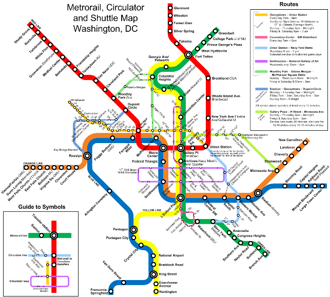

This modified version of the Washington DC Metro Map was designed by the Greater Greater Washington. The map shows metro stations coinciding with DC Circulator bus stops, H Street Shuttle stops, and Georgetown Metro Connection stops.
The Metro Maps listed below are in Image format, and PDF format which requires Adobe Acrobat Reader for viewing.
![]() Metro Map - PDF Format
Metro Map - PDF Format
![]() Metro Map - Image Format
Metro Map - Image Format