

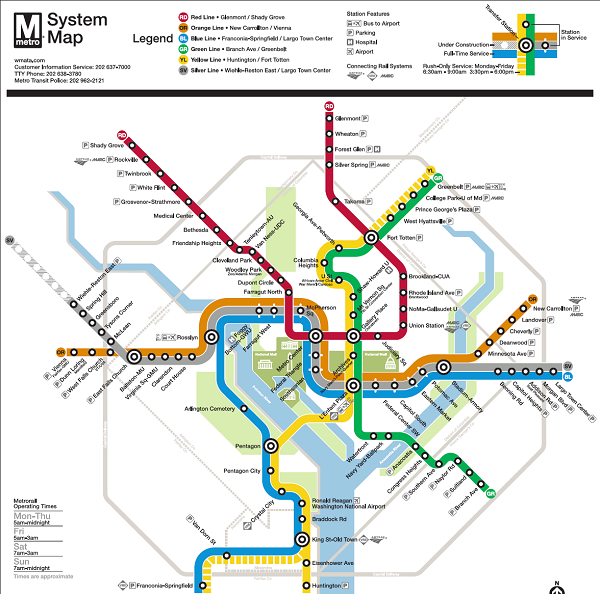
The Metro Map provides a quick overview of metro connections to destination points in Washington DC, Virginia, and Maryland.
There are two maps: one in color, and another in black and white. To download a printable version of the map, right-click on the link below and depending on your browser, click on "Save Target As" or "Save Link As". Note: The maps are in PDF Format requiring Adobe Acrobat Reader for viewing.
 Metro Map - PDF Format, Black and White (472 KB)
Metro Map - PDF Format, Color (472 KB)
Related Information
|
|
Metro |
|
|
|
Metrobus |
|
|
|
Metro Pocket Guide |
|
 |
DC Circulator |
|
 |
SmarTrip |
|
Washington DC Metro
Metro is the subway system connecting Washington DC, Virginia and Maryland. The system is operated by the Washington Metropolitan Area Transit Authority (WMATA).
New riders can learn about the basics of the Metro System by visiting both the Rail and Bus sections of this website. The Tips page will have you traveling like a skilled veteran in no time.