

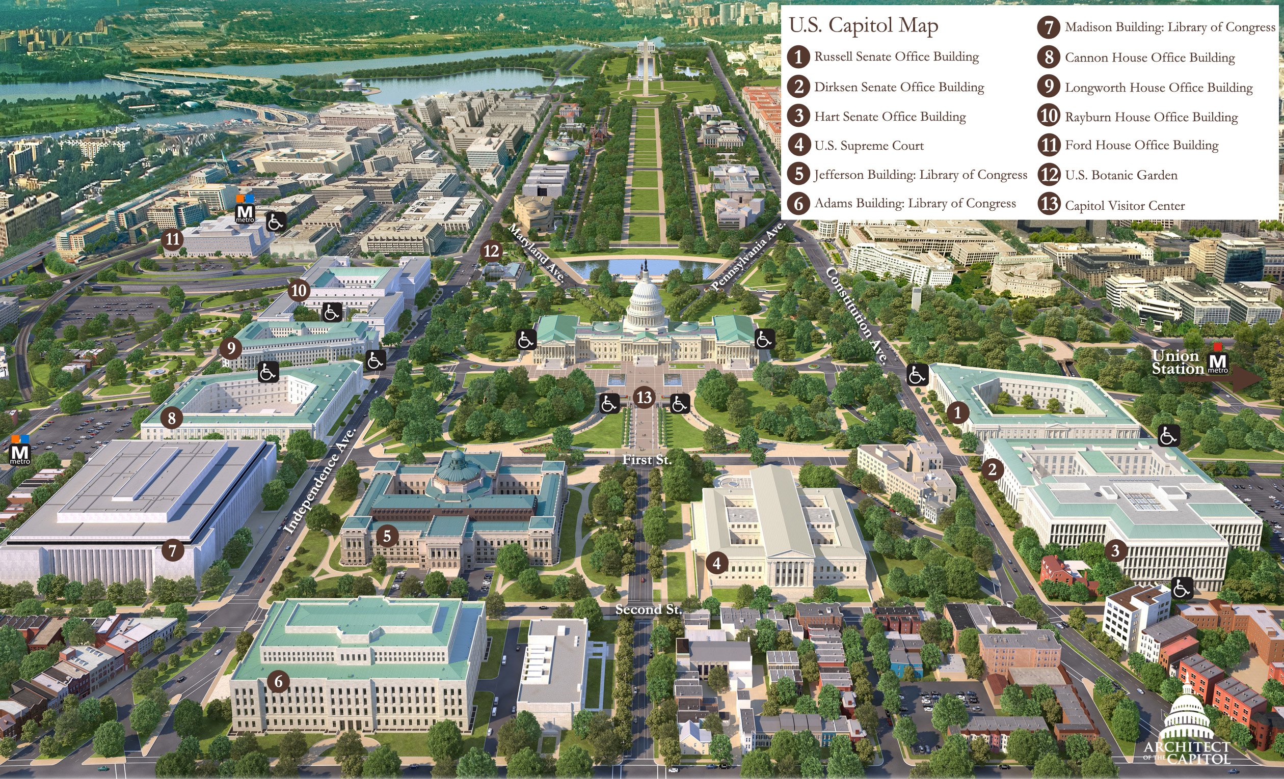
The Capitol Map shows the location of the U.S. Capitol Building, including the Supreme Court, Senate Office Buildings, House Office Buildings, the Botanic Garden, the Capitol Reflecting Pool, and the Library of Congress. The map also shows the closest metro stations to the U.S. Capitol Building.
To download a printable version of the map, right-click on one of the links below and depending on your browser, click on "Save Target As" or "Save Link As". Note: The maps are in PDF format requiring Adobe Acrobat Reader for viewing.
 U.S. Capitol Complex Map (PDF Format)
U.S. Capitol Demonstration Areas Map (PDF Format)